Watching a City Breathe on Constitution Day
· 3 min read
Every May 17, a wave of people moves through Oslo. Families gather along the parade route in the morning, the children's parade walks through the city centre through lunchtime, and the crowd drifts down to the waterfront for the rest of the afternoon. Everyone in Oslo knows this rhythm. We wanted to see if we could watch it happen, live, from the data.
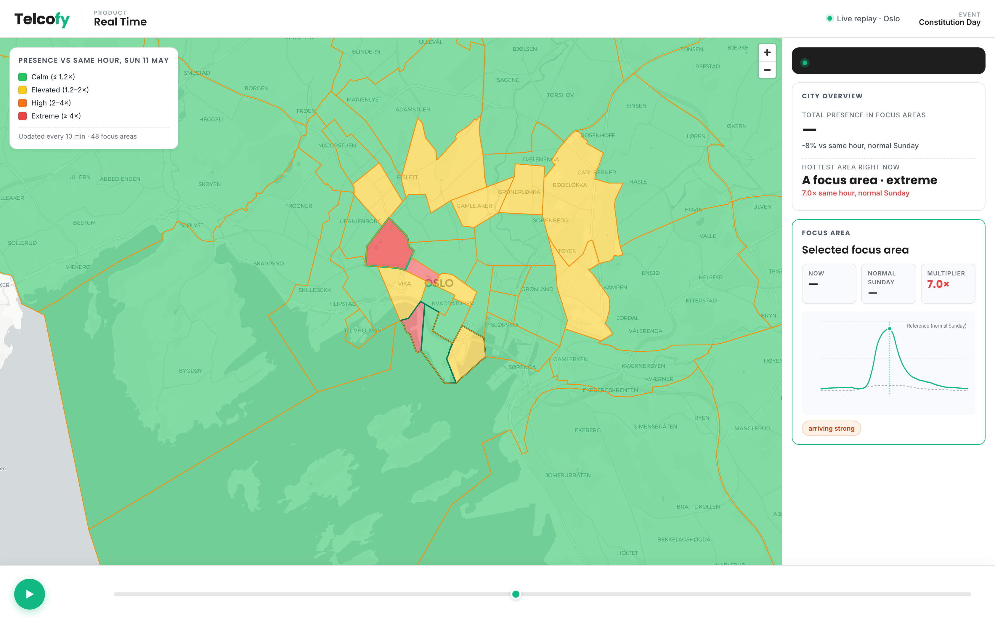 Parade peak. The focus areas along the route light up; the surrounding city stays close to its normal Sunday. The busiest area in this moment runs around seven times its usual presence at the same hour.